

What App Should I Use to Fly My DJI Drone on My Farm?
First of all, why DJI drones? DJI drones are among the most popular and easy to fly drones on the market today (models such as Phantom and Mavic). The choice about what app to use should be based on the goals of the flight.
There are many apps that can be used to fly a drone. I will focus on three free apps (DJI GO 4, DJI GS Pro, and Pix4DCapture) that I often use to fly our Phantom 4 Pro. With the exception of DJI GS Pro, the apps are available for both Android and IOS devices. I am not going to dig into too much detail about each app. There is a wealth of information online covering those topics. My goal is to provide some guidance on what app to use for different purposes on your farm.
If you are planning to fly a drone around to capture videos and pictures of your property, DJI GO 4 would be my recommendation. The app will give you a live view from the camera and allow you to easily switch between picture and video, among many other features.
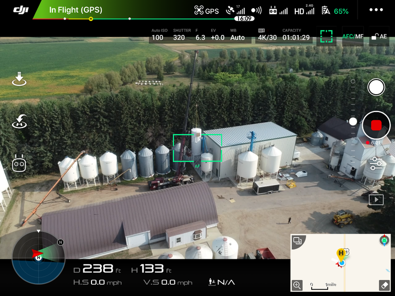
Figure 1. DJI GO 4 app main screen.
If you are planning to use your drone as a scouting tool, the DJI GS Pro would be my recommendation. The app allows you to create a route of waypoints (Figure 2) just by touching the screen. The route can be adjusted by dragging the points around and/or by adding points. Once the route is finalized, one can set actions for each point (hover time, gimbal angle, capture a photo, etc.). Once parameters are set for one point, they can be pasted to all points. On this type of mission, pictures will be taken at each point only, which is different from a survey mission.
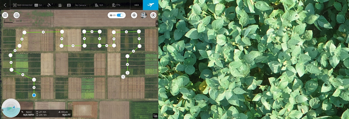
Figure 2. DJI GS Pro waypoint mission example (left) and a zoomed in picture collected during that mission (right).
To fly a survey mission (to map a large field), I would recommend Pix4Dcapture (Figure 3). Two of the reasons I like Pix4Dcapture are the templates for the different types of missions (polygons, grid, double-grid, and circular), and because it saves the previous missions (under project list) and the “duplicate” feature allows you to fly the same mission over and over again. The grid and duplicate mission features have saved me a lot of time on mission planning!
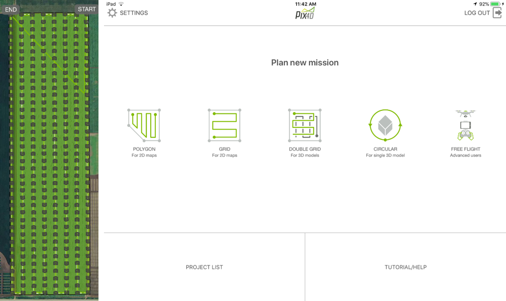
Figure 3. Grid mission example (left, approximately 40 acres) and Pix4Dcapture app main screen (right).
If you need help using the apps listed above, you are welcome to send me an email (Paulo.flores@ndsu.edu) or give me a call (701.652.2951), and I will do my best to assist you. The last thing that I will mention, and it applies to all apps, is that you will have a better experience flying drones using a tablet type devices (larger screen), instead of using smaller screen devices (smartphone).
Paulo Flores, Ph. D.
Paulo.Flores@ndsu.edu
Precision Ag Specialist
