

Using Single Drone Pictures to Scout Your Fields
Some of the most common drones in the market have cameras with resolutions between 12 and 20 megapixels (MP). In addition to the camera, altitude and size of the target are key factors in determining ground resolution. At the Carrington Research Extension Center, we have a DJI Phantom 4 Pro, which has a RGB camera with a 20.1 MP resolution. Below you will find some pictures captured with that drone; all single pictures without any post processing. We will check how flight altitude affects our ground resolution and hopefully that will provide you with useful information to help you plan your flight for different purposes in your fields.
The bigger yellow box shows a zoomed-in view of the small yellow box in each picture.
It is unlikely that you be able to do stand counts on corn (around V3 leaf stage) flying at 190 above ground level (AGL), but you can still spot some weeds (Figure 1).
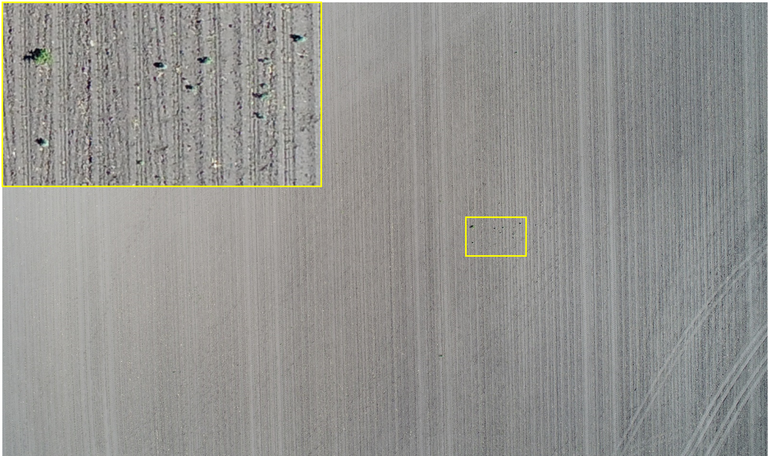
Figure 1. Corn field picture captured on 06/04/2017 at 190 ft AGL.
But you can accomplish that flying at 40 ft AGL, as shown below for sunflower just 1-2 days after emergence (Figure 2).
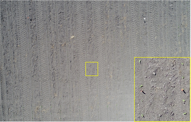
Figure 2. Sunflower plots picture captured on 06/08/2017 at 40 ft AGL.
Now, if you want to scout your field early in the season to identify weeds, check plants for leaf damage, or just the general look of the plants, then you need to be a little closer to the plants. Below are some examples of pictures taken at around 20 ft AGL.
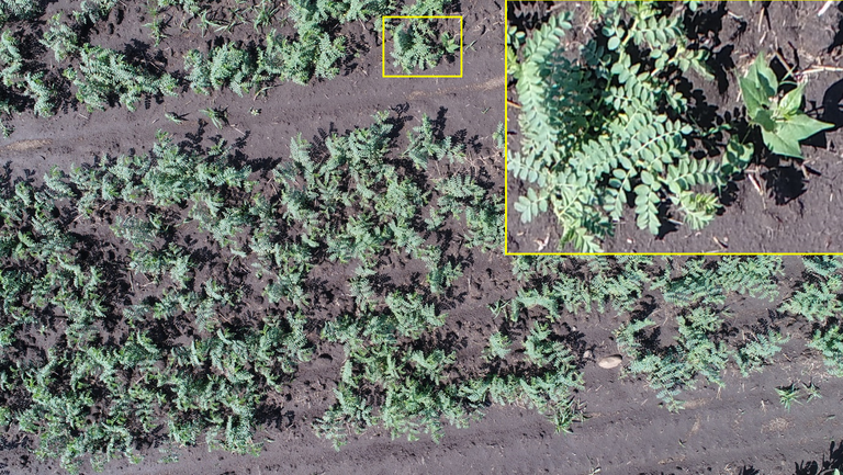
Figure 3. Chickpeas picture captured on 06/14/2017.
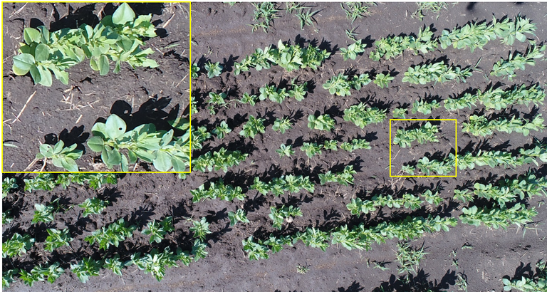
Figure 4. Fababeans picture captured on 06/14/2017.
If you are using a drone to scout for weed infestation or to check on your weed control, you might be able to accomplish that flying a little higher. Check the examples below.
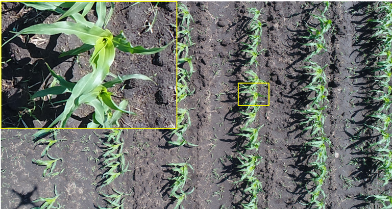
Figure 5. Corn (around V5) picture captured on 06/14/2017.
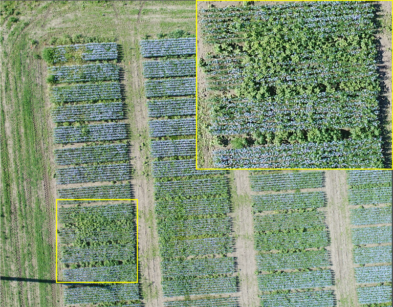
Figure 6. Weeds in flax. Picture taken at 120 ft AGL on 07/05/2017.
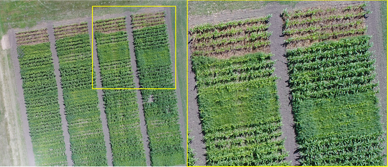
Figure 7. Corn weed control plots. Picture taken at 180 ft AGL on 07/13/2017.
The picture below shows some of the things that you can expect to see from higher altitudes, in this case, 360 ft AGL. As one can see in Figure 8, the plant in the large plot (towards the middle of the picture) shows a yellowish color for both crops: corn (bottom) and sunflower (top). In addition, one can see that there are some stand issues, especially for the sunflower, on both ends of the plot. Flying that high will allow one to cover a large area per flight, but do not expect to see much plant level details in the pictures.
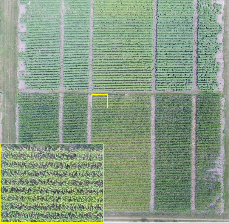
Figure 8. Corn and sunflower plots. Picture taken at 360 ft on 07/27/2017.
As always, please keep safety as a top priority when flying out there. Fly at altitudes that you are comfortable with. The closer to the ground, the less time you have to recover from any problems with your drone. Capturing single pictures across a field can be an efficient and quick way to scout your fields, since those pictures do not require any post processing.
Paulo Flores, Ph. D.
paulo.flores@ndsu.edu
Precision Ag Specialist
