

Potential Uses for Your Drone Early in the Growing Season
As we start a new growing season, some farmers might be looking for ways to incorporate drone imagery into their operations. Applications of drone imagery at this point in the growing season could be stand counts and weed spotting.
Stand Counts
I believe many farmers will be interested in information regarding stand counts in their fields, and many drone imagery service providers offer tools that can provide that information with almost all of them offering a free trial period for new users. What is not very clear most of the time on those service providers’ websites are the conditions under which the flights need to be performed to acquire imagery with adequate resolution to perform stand counts. The other key factor is what growing stage of the crop one should fly. For the farmer, the earlier the better, so he/she will have an appropriate timeframe to make a management decision based on the data.
I am confident that we can do a stand count in corn at V2 stage with a mulstispectral camera (MicaSense RedEdge, in our case) flying at 75 ft AGL (0.61 in/pixel), maybe at 125 ft AGL (1.02 in/pixel), but not so sure about 175 ft AGL (1.43 in/pixel) (Figure 1). When the pixel value gets too big (0.61 vs. 1.43), it might become bigger than the target of interest, corn plants in our case, making it difficult to separate the target of interest from the remaining background. Cameras on popular drones, such as the DJI Phantom 4 Pro (P4P), have better resolution than multispectral ones when flying at the same altitude. At 175 ft, the P4P’s camera outputs imagery with a ground resolution around 0.57 in. We just did some flights with both cameras at 75, 125 and 175 ft AGL to help clarify some of these things, but we have not fully processed the data yet.
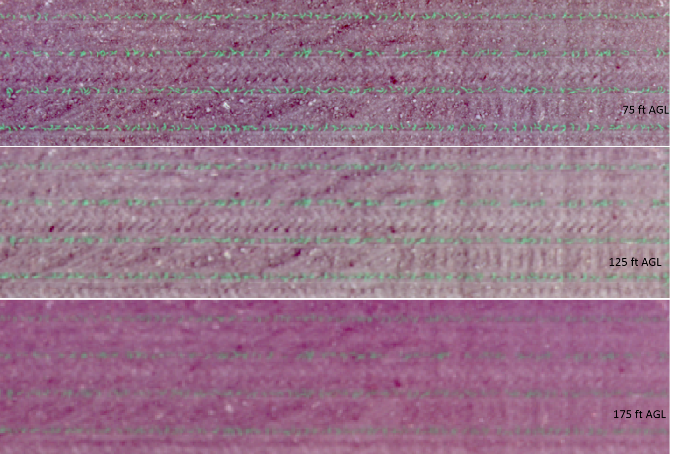
Figure 1. Flight altitudes and its impact on image resolution in a corn field (multispectral camera).
Weed Spotting
I have noticed this season the occurrence of weeds either in patches or spread throughout the whole field in some of our plot research imagery. I can easily spot weeds in imagery collected with our multispectral camera at 200 ft AGL, but I believe that one could see that even flying a little higher and using the NDVI layer to look for those. One tip if you want to try spotting your weeds: look at the NDVI layer using a black and white symbology, instead of colors normally seen for NDVI (ranging from red to green). I have spotted broadleaf weeds in small grains (Figure 2) and corn trials using the NDVI layer. I believe this is the kind of information that could be used by a farmer to rank the fields that should be sprayed first, so weeds do not get out of control in fields with higher weed pressure.
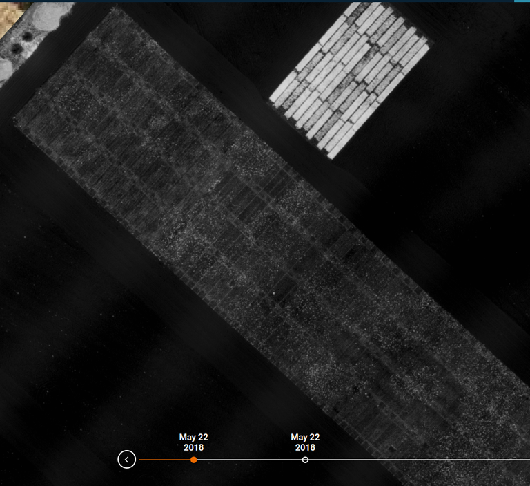
Figure 2. NDVI image showing occurrence of Canada thistle (the bright patches in the lower plots) in an organic small grain field.
Paulo Flores
Paulo.Flores@ndsu.edu
Precision Ag Specialist
