How Can You Use Your Drone Around Your Farm?
To comply with FAA small UAS rule (14 CFR part 107), anyone who wishes to fly a drone for work or business is required to obtain a Remote Pilot Certificate. You can find more information about becoming a certified remote pilot here https://www.faa.gov/uas/getting_started/fly_for_work_business/becoming_a_pilot/.
So, you have a drone. How can you use it around your farm?
Maybe you can start by taking a picture of your farmstead.
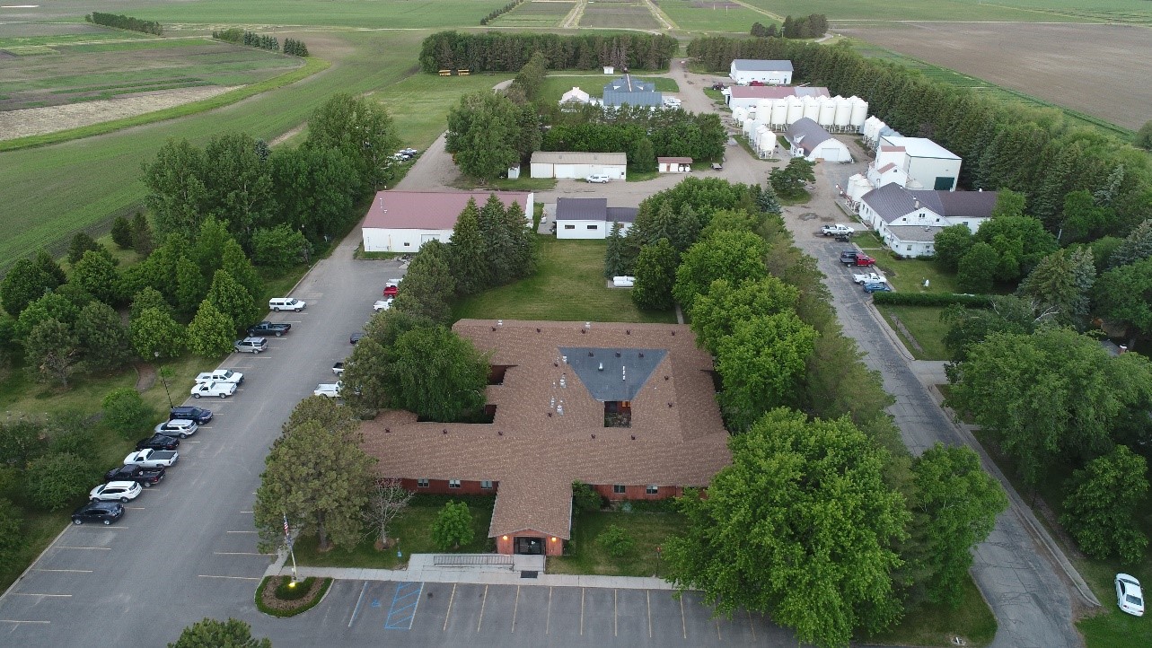 Carrington Research Center headquarters. Altitude around 250ft above ground.
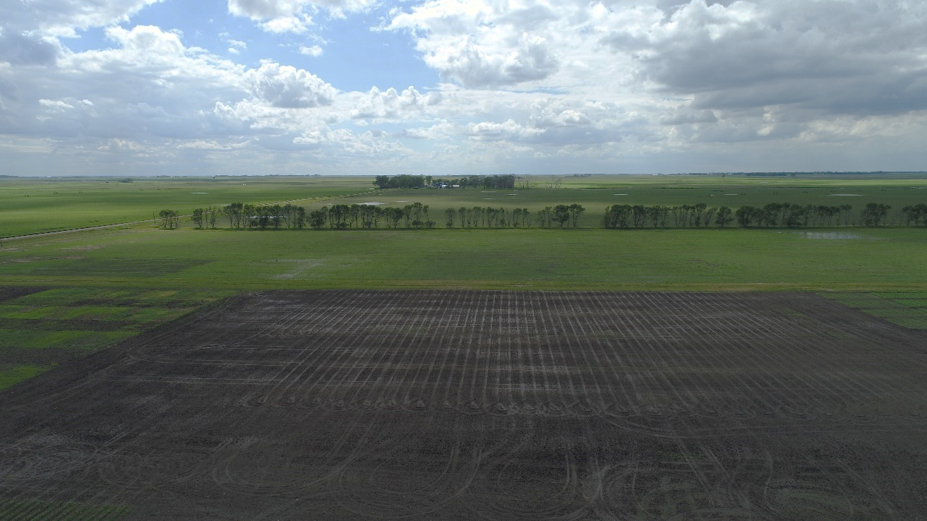
Maybe you are just interested in a general view of your fields.
How about taking a look at your fields’ drainage after a rain event?
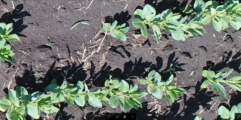
If your goal is to use your drone for crop scouting, one option would be to fly low, at a safe altitude, and capture individual pictures with a high level of detail (like the one below). Once you have those pictures, you can download them to your laptop or desktop computer and look at them in more detail, zooming in and out. Can you see the holes in the leaves in the picture below?
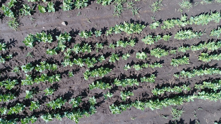 Faba beans – 20ft above ground level. Date 06/14/2017.
Did you find the holes in the leaves? If not, take a look on the right side of the picture, third row from the bottom, and 5-6 plants from the edge of the picture. Zoom in and try to find some other damaged leaves.
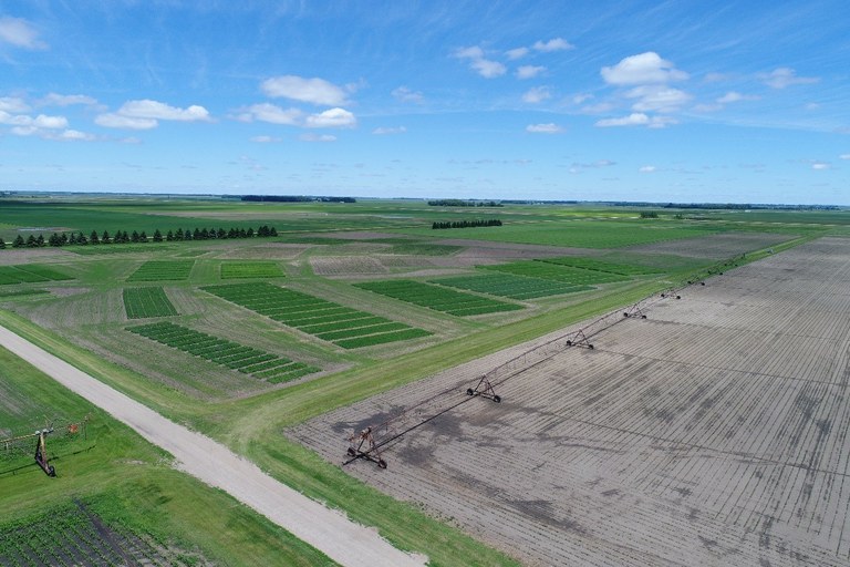
If you are interested in flying a large area, I would recommend much higher altitudes. As an example, I flew the area below (around 80 ac) at 270ft above ground. It took me around 23 minutes to do it (one battery) and I end up with 490 pictures from that field. So, what do you do with 490 pictures? Look through all of them one by one? In my office, I have a software that stitches all this pictures together to form a larger, single picture (orthomosaic). This larger picture is georeferenced, so we can find the exact location of each point on the orthomosaic using a GPS device or equipment that has a GPS receiver.
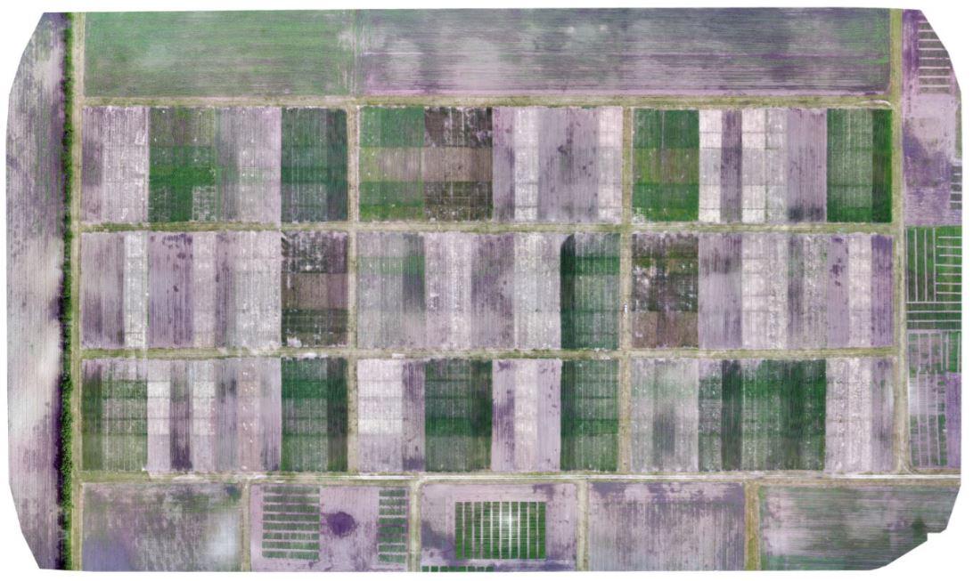 Carrington REC fields. Altitude 270ft above ground (around 80 acres).
I realize that most people do not have access to the software packages that I have, but there are options out there that would allow one to create orthomosaics from imagery captured with a drone. Cloud based services such as DroneDeploy (www.dronedeploy.com) and PrecisionMapper (http://www.precisionhawk.com/precisionmapper) are among the most popular drone image processing services and they offer free trial periods. After the trial period, one can keep using these services with some limitations.
Though flying a drone can be fun and exciting, I would encourage everyone to keep safety as a top priority. Drone crashes happen all the time, and yes, it can happen to you, too. I found this 10 minute video online “Drone Flying tips – 7 mistakes to avoid” (https://www.youtube.com/watch?v=eEKJq9tU85A) and I would encourage you to watch it before your next flight.
Safe flights everyone!!!
Paulo Flores, Ph.D.
paulo.flores@ndsu.edu
Precision Agriculture Specialist
+++
Just in case you could not find the holes in the faba bean leaves above, here is a closer look.