Unmanned Aerial Systems Research at the Carrington REC – An Update
North Dakota State University does not endorse commercial products or companies even though reference may be made to tradenames, trademarks or service names.
Researchers at the Carrington REC started to explore the use of Unmanned Aerial Systems (UAS) for agricultural purposes in 2014. During that season, seven flights took place over the CREC research plots collecting preliminary data. Those flights covered a limited number of trials and usually trials were flown only once. The research team quickly realized that more flights and repeated flights over the same area during the growing season would be needed to determine how this technology could be most usefull for crop production.
In 2015, three flights were flown at the CREC, but due to technical issues with the sensor (camera) the data collected was determined to be of limited value.
At the end of 2015 a research team from the CREC, along with other NDSU collaborators, sucessfully secured funding from a precision agriculture program administrated by the NDSU Agricultural Experiment Station. Since then, we have purchased a UAS (AgBot) and a multispectral camera (MicaSense RedEdge), which allows us to fly more often and to define flight schedules best suited for particular research objectives.
In 2016, we flew more than 80 flights over 16 days covering the majority of the CREC’s land base. These flights captured around 14,000 images from more than 150 trials at the CREC and at the Oakes Irrigation Site. Much of the data collected still needs to be analyzed and cross referenced with the ground data collected during the growing season. Listed are examples of the results that we have been able to process up to this date.
- Corn Stand Counts: Corn was planted on May 1 and flown on May 23, 2016. So far, the best results have been seen when flying at 50 ft above ground level (AGL) using NDVI (black and white color scheme). In a area of around 1 acre in size, we counted 31,189 plants. Futher work is needed to break that area into small plots where we can then count the plants and compare to other counts in our process of ground proofing the data.
- GreenSeeker NDVI data versus UAS NDVI data: Correlations between GreenSeeker NDVI and UAS-NDVI have shown very good correlations (R2>0.85) for most of the trials that we have processed.
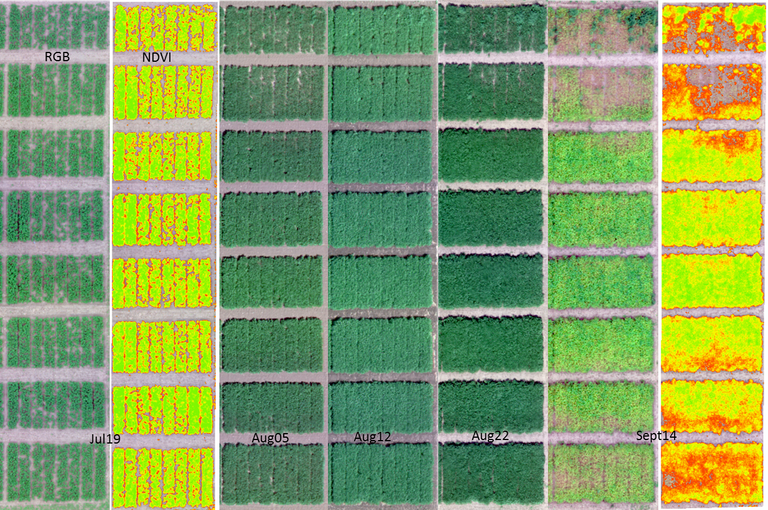
- UAS NDVI versus soybean yield and plant maturity: UAS-NDVI collected on August 5 correlated well with plant maturity (R2=0.86) and yield (R2=0.90). Flights from August 12 and 22 showed similar results.
- UAS NDVI versus barley disease assessment and yield: the best correlation (R2=0.71) between UAS-NDVI and yield was found when we flew the trial on July 21. Very encouraging results were found when we correlated levels of incidence of leaf spot diseases on flag leaf-1 with UAS-NDVI on July 15 (R2=0.77) and July 21 (R2=0.76).

RGB and NDVI mosaics of a soybean trial flown on five days during the 2016 growing season at the Carrington REC.
We are looking forward to the winter months when we will process the remaining data collected and see what further information we can learn on how to use this new technology. The CREC personnel look forward to sharing some of that information with our constituency during the meeting season.
Paulo Flores, Ph. D.
Nutrient Management Specialist


