Site-specific Farming: What is Site-specific Farming? (SF1176-1, Revised March 2018)
Availability: Web only
Site-specific farming is doing the right thing at the right place at the right time
Site-specific farming requires a different way of thinking about the land. The legal description of a field is defined by a surveyor and an attorney. Fields are a certain shape because of human decisions. However, soils within these boundaries are variable due to forces of nature and human activity. Nutrient properties of these soils can be different due to past nutrient application practices. Crop productivity is variable within fields due to soil property differences. Some differences between soils are small, but often the differences are large. Site-specific management is used to detect and measure the differences within fields, record these differences at specific locations and then use this information to guide changes in management or inputs. Site-specific farming is managing areas within fields, rather than using the same management on the entire field.
How can a farmer begin using site-specific farming?
Some farmers believe that site-specific farming is prohibitively expensive and that costs cannot be justified in dryland fields for grain crops. Studies conducted at NDSU and in the region have shown low-cost site-specific tools that yield beneficial results are available.
To conduct site-specific farming, a producer must be able to do three things:
- Know where you are
- Gather information at that location
- Do something about it
Knowing where you are
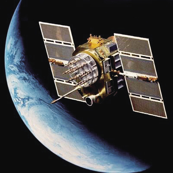
GPS (global positioning satellite) receivers are becoming so common that they are a part of everyday life for many Americans. Hunters and fishermen use GPS receivers. GPS receivers are in rental cars, in our own cars, in cell phones, wrist watches and golf carts. The GPS signal is part of the “peace dividend” from the end of the Cold War. The U.S. Department of Defense has a system of satellites in geosynchronous orbit around the Earth that transmits signals to any receiver designed to analyze the signal. Combined with a very accurate time measurement within the satellite, the receiver on Earth can determine its location within an inch to several feet, depending on the processing capability of the receiver.
Because of slight errors caused by atmospheric conditions, a GPS-only satellite receiver can err a few feet to many feet. A GPS receiver that can receive a “differential GPS” (DGPS) signal can correct for these errors.
Some DGPS signals are free and some require a subscription. One free signal in the region is the WAAS (wide-angle augmentation system) differential. The WAAS signal is provided by the Federal Aviation Administration to support air traffic, but receivers are available that take advantage of that correction signal. Commercial GPS providers also have access to subscription DGPS signals from private satellite companies that also provide DGPS services.
For extremely accurate GPS, especially for elevation (all GPS provides elevation estimates, but the error vertically is typically three times horizontal error), RTK (real-time kinetics) GPS is available. The RTK system requires either a base station or a subscription to a company that has base tower signals available. The Rural Tower Network in the Red River Valley is an example of a private consortium of companies that have built a network of RTK towers with RTK correction signals available to people who subscribe to the service. RTK allows subinch horizontal and elevation measurements and supports activities such as auto-steer, strip till, drainage activities and accurate elevation mapping.

Global Positioning Satellite system satellite array around Earth. (NASA image)
Gathering information
Information about locations within fields can be gathered by using sensors or by sampling. Use of sensors is by far the easiest method, but sometimes information on certain inputs, such as crop nutrient requirements, is best determined with sampling. Sensors that are commercially available include:
- yield monitors
- soil electrical conductivity or electro-magnetic sensors
- remote imagery, including satellite images, aerial photography and hand-held active sensors
- soil compaction sensors
- on-the-go soil pH (alkalinity or acidity) sensors
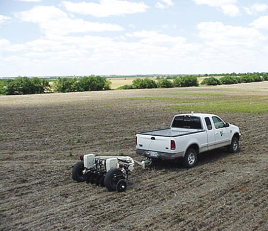
Electrical conductivity soil sensor. (Photo courtesy of Veris Technologies)
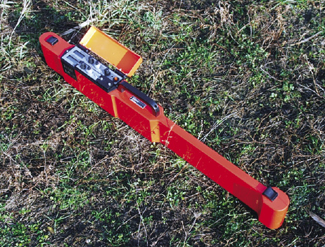
Electro-magnetic soil sensor. (Photo courtesy of Geonics Inc.)
Yield monitors (see “Yield Mapping,” NDSU publication SF-1176-3) collect yield and moisture data while the harvester is operating. After the data is cleaned (outliers removed and GPS inaccuracies corrected), a map can be developed to show areas of productivity. Yield monitors for site-specific purposes always should be connected to a DGPS receiver.
Soil electrical conductivity (EC) sensors or electro-magnetic (EM) sensors have been used to map a combination of soil properties. The sensors are sensitive to soil organic matter, clay, moisture and soluble salts. In this region, the resulting measurements are a combination of all of those properties. The patterns have been useful in directing zone soil sampling and also in pinpointing high-salt areas.
Remote sensing is the most common sensor used in the region for managing crops. Landsat 5/7 satellites provide multispectrum images at a resolution of about 100 feet. This sounds like the images would be very coarse; however, many important soil features are often larger than one-half acre, so the resolution works well for these larger features. The normalized differential vegetative index (NDVI) bands have worked well to identify important soil and nutrient availability features in growing crops.
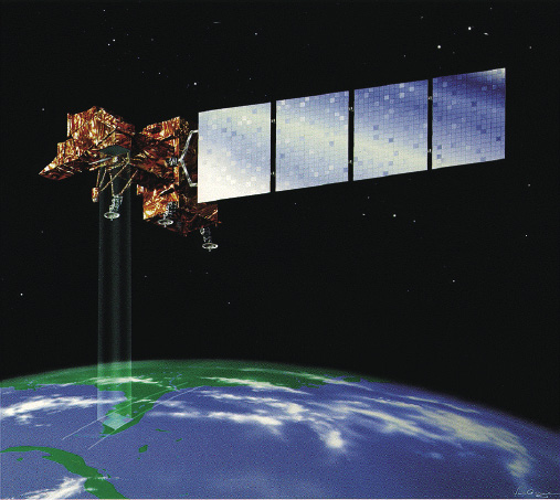
Landsat 7 satellite. (NASA image)
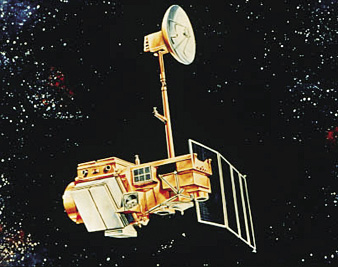
Landsat 5 satellite. (NASA image)
Choosing a growing-season time window to obtain a satellite image when the crop is filling in the rows, but has not yet flowered, is often important to obtain a meaningful image. With most satellites, given the budget that growers have, picking a specific date is not possible. The satellites typically pass over an area only every several days. If clouds obstruct the view during that time, a grower will need to wait until the next pass. For many management uses, an archived image that is several years old may be as meaningful as a current-year image.
Aerial photography produces images that are much more detailed in resolution than Landsat images; however, finding a pilot willing to take the pictures at the right time may be difficult. For fields up to 80 acres, flying at about 5,000 feet above the surface and taking the photo straight down (nadir) is a good method. Cloud cover, especially broken cloud cover, will confound the best intentioned aerial crop photo.
Hand-held active optical sensors are available and can be attached to a farm implement when another field operation is being made. These sensors produce an image at a much finer resolution than most satellites at a time in the season that is important to the producer. These sensors emit their own light, and the light registered by the sensor on reflection is the light reflection from the sensor. All other ambient light is excluded. This makes the sensor readings the same regardless of time of day, or whether the sky is cloudy or not.
The power of these active sensors is its ability to delineate areas of a field that are more or less productive at a fine scale at a time of the user’s choosing. This information can be used directly in formulas for inputs for which rates or use are related to crop productivity or soil properties related to the sensor readings. The delineations created by these tools can be used by themselves or with other data files to direct sampling for soil or plants.
Zone soil sampling is based on the concept that residual crop nutrients are in patterns for some logical, predictable reason. Years of research in the region have shown that zone soil sampling for residual nitrate is much more economical and meaningful than any reasonably obtained grid soil sampling. Data that has been shown to be useful in zone sampling include topography (landscape from elevation data), soil EC, yield frequency maps and remote imagery (See “Soil Sampling and Variable-Rate Fertilizer Application,” NDSU publication SF-1176-2). In most studies, two to six zones per field were as meaningful as 36 grid samples in the same field. Zone sampling is very economical, and the patterns it produces usually represent the patterns of residual soil nitrate in the region.
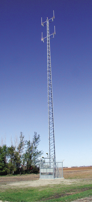
RTK (real-time kinetic) GPS base tower. (Photo courtesy of Rural Tower Network)
Doing something about it
Variable-rate controllers are available for whatever inputs need site-specific management. Liquid materials including fertilizers and manure, dry materials including fertilizers and manure, anhydrous ammonia, seed, agricultural chemicals and planter-applied starter fertilizers all can be varied with any number of pieces of equipment. Existing flow-monitoring consoles also can be modified to control the application of materials site-specifically. The data-input device can be as small as a PDA (personal digital assistant) or a laptop computer. Variable-rate application equipment can be as large as a commercial fertilizer applicator or as personal as a variable-rate seeder or anhydrous ammonia applicator. Most controller consoles today have been developed to work with several application devices. Checking with equipment manufacturers to determine which consoles would work best for a certain suite of application needs would be wise. Many companies also have site-specific experts on staff to aid in selection of the appropriate tools for making site-specific farming work for growers.
Managing data
Another fear of growers regarding site-specific farming is the perception that they need to be a computer programmer to succeed. This region has a number of site-specific consultants whose entire business is based on helping growers begin and successfully continue farming site-specifically. These consultants will have suggestions regarding products to consider and the types of data to collect. They will be able to produce the maps and digital application instructions your tools will need to perform their site-specific tasks. Many growers using site-specific tools today are no more experts in computers than the normal person. However, they have a consultant who knows how to handle the data.
The benefits
Site-specific farming allows producers to take charge of many aspects of production that previously were assumed to be random acts of chance. It makes producers curious about problems in the field and provides the tools to correct many of them effectively. It provides methods to test varieties, input rates and new products on their farm and analyze the results easily and with confidence. Some growers will benefit from variable-rate application. Some will benefit from changes in management. Others will benefit from GPS-guided machinery or archived production information. The public benefits from inputs being applied at appropriate rates to all areas of the field and limiting exposure of sensitive areas to excess nutrients or chemicals.
Site-specific farming need not be prohibitively expensive. Methods have been tested to minimize costs and maximize benefits. Equipment costs have decreased since the inception of site-specific farming about 20 years ago so that all growers, regardless of size of operation, can participate if they choose to do so.
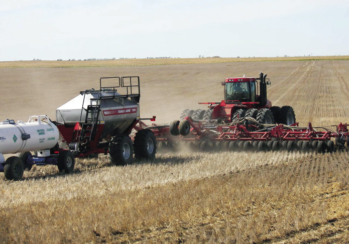
Variable-rate seeding/fertilizing. (Photo courtesy of Amity Technologies)
Reviewed and reprinted March 2018


